
Paterson ZIP Codes by Delivery Area
Paterson uses several delivery labels, not one citywide ZIP. The working inventory below preserves what official USPS sources actually observe: routing areas, label lists, and a few documented address examples. It does not turn a routing list into a municipal-boundary map. For a disputed address, use the official USPS result first, then confirm the parcel municipality with county records.
| ZIP | Areas Covered | Post Office | Notes |
|---|---|---|---|
| 07501 | Paterson routing and official-record address use | Paterson 07501 label route | Included in the 194 Ward Street SDC service list |
| 07502 | Paterson label and routing area | Paterson 07502 label route | Municipal crosswalk was not located |
| 07503 | South Paterson address examples | South Paterson Station | Also appears in the Paterson 07501 labeling list |
| 07504 | Paterson SDC and label route | Paterson routing label | Neighborhood crosswalk was not located |
| 07505 | Paterson SDC and label route | Paterson routing label | Used in the 2025 label-container routing update |
| 07509 | P.O.-style route in USPS lists | Paterson SDC route | Exact delivery or station scope was not located |
| 07510 | Paterson SDC list and Main Post Office suffix | Main Post Office, 194 Ward Street | Postal facility suffix, not a municipal map |
| 07513 | Paterson SDC list and official local examples | Paterson routing label | Neighborhood crosswalk was not located |
| 07514 | Paterson SDC list and city-document examples | Paterson routing label | Neighborhood crosswalk was not located |
| 07522 | Paterson SDC list and city-document examples | Paterson routing label | Neighborhood crosswalk was not located |
| 07524 | Paterson SDC list and city and county examples | Paterson routing label | Neighborhood crosswalk was not located |
| 07533 | Paterson 07501 labeling list | Paterson 07501 label route | P.O.-box or route distinction was not located |
| 07538 | Paterson 07502 labeling list | Paterson 07502 label route | Municipal boundary was not located |
| 07543 | Paterson 07501 labeling list | Paterson 07501 label route | P.O.-box or route distinction was not located |
| 07544 | Paterson SDC and labeling list | Paterson SDC route | P.O.-box or route distinction was not located |
A ZIP code directory is most useful as a postal starting point. The list includes labels that may serve broader delivery patterns, and official research did not produce a complete neighborhood-to-ZIP crosswalk. Use a full address result rather than inferring a ZIP from a nearby address.
Paterson ZIP Code Lookup Modes
USPS ZIP Lookup is the definitive tool for delivery labeling. It offers three distinct modes. By Address resolves a complete delivery address; By City and State returns ZIP information from a place name; and Cities by ZIP identifies city labels associated with a ZIP. Those outputs describe mail routing, so they should not be treated as proof that a named person or company occupies an address.
| USPS mode | Required fields | Optional fields | Use in a Paterson ZIP search |
|---|---|---|---|
| By Address | Street Address, City, State | Company, Apt/Suite/Other, ZIP | Best route for confirming one exact mailing label; a unit may be needed when multiple matches exist. |
| By City and State | City, State | None documented | Checks the set of postal labels associated with a city entry. |
| Cities by ZIP Code | ZIP | None documented | Shows city labels tied to the ZIP, not a city-limit decision. |
Enter the apartment or suite when it is known. USPS warns that a ZIP response does not establish who occupies the address, and a street match can need a unit number before delivery data is specific enough. That limitation matters when a Paterson ZIP code is used to check a record trail.
Note: USPS can verify a delivery label, but it cannot replace a municipality, parcel, or title record.
Paterson ZIP Routing at 194 Ward
The USPS Main Post Office is at 194 Ward Street, Paterson, NJ 07510-9998. USPS lists published service hours of Monday through Friday, 8:30 a.m. to 5 p.m., and Saturday, 8:30 a.m. to 1:30 p.m. The same Ward Street location is used by the Sorting and Delivery Center with a 07510-9900 suffix. South Paterson Station is listed separately at 958 Main Street, Paterson, NJ 07503-9998.
The USPS listing for the Paterson Main Post Office is the source for the facility view shown here.
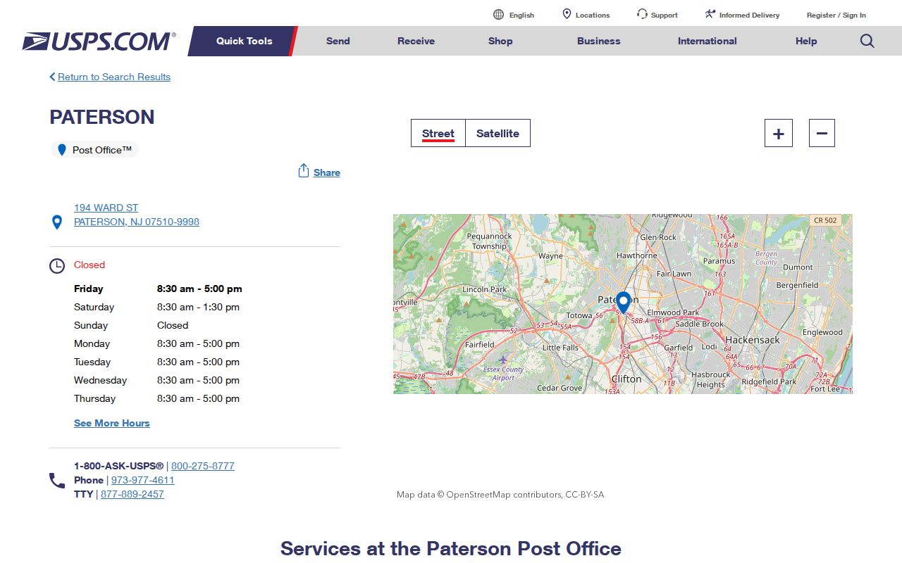
The facility record supports a postal-service check, while the address itself still needs an exact ZIP lookup when the label is uncertain.
A February 22, 2025 USPS bulletin announced the Paterson SDC and listed 07501, 07504, 07505, 07509, 07510, 07513, 07514, 07522, 07524, and 07544 as served ZIPs. That is a delivery-routing observation. It does not say that each ZIP falls wholly inside Paterson.
Find Residents Within a Paterson ZIP
A ZIP can narrow an address search, but the official local systems do not create a broad name directory from that number. Begin with the full address and keep the delivery label separate from municipal and parcel identifiers. Once a result is anchored to a parcel, the address-level route is covered in the Paterson street directory.
- Use USPS By Address to confirm the delivery ZIP and include the unit when it affects the result.
- Query the Passaic County GIS parcel service by an address or its returned parcel keys, then review ZIP_CODE or ZIP5 as a parcel attribute.
- Record municipality, block, lot, PIN, and property location before relying on the postal field.
- Use the official Board of Taxation entry page to reach the Property Tax Search Tool, then verify which live fields are available.
- Move to the record system that fits the question. A deed trail uses PRESS and a voter-status question uses the state status tool, neither of which is a ZIP-wide resident search.
Paterson parcel data can include a ZIP field, but the county says its GIS polygons are planning representations compiled from tax-map material, not legal surveys. A parcel ZIP also needs validation against delivery data and municipal jurisdiction.
Paterson ZIP Fields and Portal Limits
The county GIS layer is the documented local system with ZIP fields. Its parcel schema includes ZIP_CODE, ZIP5, and ZIP_PLUS4 alongside property location, owner name, municipality, block, lot, deed data, and valuation fields. The service supports Query and Identify, and its published metadata allows pagination with a maximum record count of 2,000. Those fields can help compare parcels, but they do not certify an address or prove occupancy.
| System | ZIP capability | What it can establish | Important limit |
|---|---|---|---|
| USPS ZIP Lookup | Exact-address and ZIP modes | Delivery label for the entered address | Does not prove a person or company occupies that address |
| Passaic County GIS | ZIP_CODE and ZIP5 parcel fields | Parcel attributes and geographic context | Planning-grade data, not a legal survey; protected names can be redacted |
| PRESS | No ZIP-wide search documented | Recorded documents by municipality, document type, name, block/lot, or instrument | Not a ZIP-wide resident index |
| NJ voter status | No public ZIP-wide search documented | Registration-status confirmation | Not a public bulk voter-file browser |
| Paterson document center | No confirmed ZIP parcel search | Publications filtered by year and category | Not a verified parcel or household search |
The Passaic County PRESS index uses municipality, document type, name, block and lot, or instrument number. The New Jersey voter-status lookup is a confirmation tool. Neither should be described as a ZIP code directory for people.
Paterson ZIP Code Routing Update
USPS reported a label-container routing change on December 11, 2025 for 07503 and 07513. The label changed from Paterson 07503 to Paterson 07505. It is a routing change, not an announcement that residential boundaries, city limits, or neighborhood identities changed.
The distinction is practical. A later mailing label can differ from an older directory, deed, or archive request without meaning the historic street location moved. Keep the source date beside the ZIP result, especially when reconciling records from different years.
Note: Compare a dated postal label with the address printed on the record before treating a mismatch as an error.
Verify a Paterson ZIP Code First
A careful ZIP check prevents a common records mistake: treating one label as if it were the full property identity. Postal service data, parcel records, and deeds can all describe the same place in different ways. The ZIP label tells the mail route. The situs is the property location used by an assessment record. A mailing address can be where an owner receives correspondence. The legal description identifies the parcel in a recorded instrument and can omit the postal label entirely.
- Save the exact USPS address result, including a unit when one is required.
- Compare the result with the GIS property location, municipality, ZIP field, and block and lot.
- Check whether the tax record separates the situs from the owner's mailing address.
- For a deed search, carry the municipality, block, lot, and legal description into PRESS.
- Record the date of every lookup because routing labels and parcel data can change.
This checklist is especially useful around city edges and P.O.-style labels. It keeps a postal search from becoming a claim about jurisdiction, ownership, or current occupancy. If the sources conflict, ask the relevant custodian to clarify the record rather than selecting the ZIP that merely looks most familiar.
Paterson ZIP Labels and City Limits
A ZIP code is a delivery label, while a municipality is a governmental jurisdiction. The two can overlap without matching. A deed may instead use a legal description, and a property-tax record may distinguish the situs address from an owner mailing address. That is why a Paterson postal label alone cannot settle city jurisdiction, parcel ownership, or the identity of a current resident.
- ZIP
- A Postal Service routing code used to sort and deliver mail to an address or delivery area.
- ZIP+4
- The five-digit ZIP plus four added digits that narrow delivery to a smaller segment, such as a block, floor, or group of units.
- PO-style ZIP
- A ZIP appearing in postal labeling or P.O. routing material when its exact box or delivery scope has not been independently verified.
- Carrier route
- A mail-delivery grouping used by USPS operations. It is not a neighborhood boundary or a list of households.
For any record request, describe the street address, municipality, and any known block and lot rather than sending only a ZIP. That gives the custodian a usable location even when the postal label has changed or crosses a local boundary.